
Heartland of Fann mountains
Trekking in Pamirs Fann Mountains
| Destinations: | Tajikistan, Pamir-Alay Mountains, Uzbekistan | View the route map »» | |
| Duration: | 10 days / 9 nights | ||
| Itinerary: | Samarkand – Mountain camp “Artuch” – Kulikalon Lakes – Alaudin Lakes – Mutnye Lakes – Chimtarga Pass – Bolshoje Allo Lake – Maloje Allo Lake – Archimaidan River Valley – Penjikent – Samarkand | ||
GUARANTEE DATES OF GROUP TOUR 2024:
| Group №1. 18.07–27.07.2024 | Group №2. 15.08–24.08.2024 |

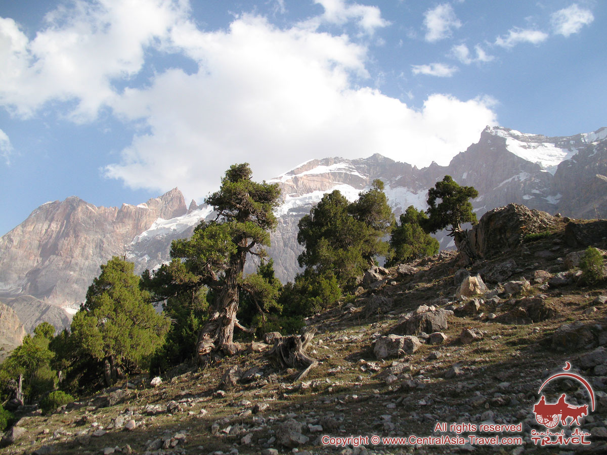
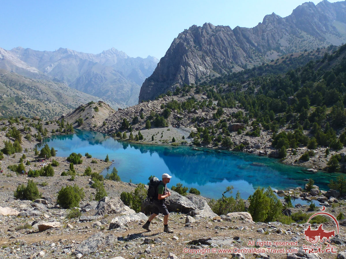
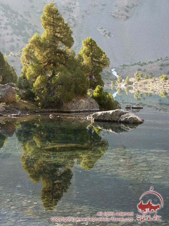
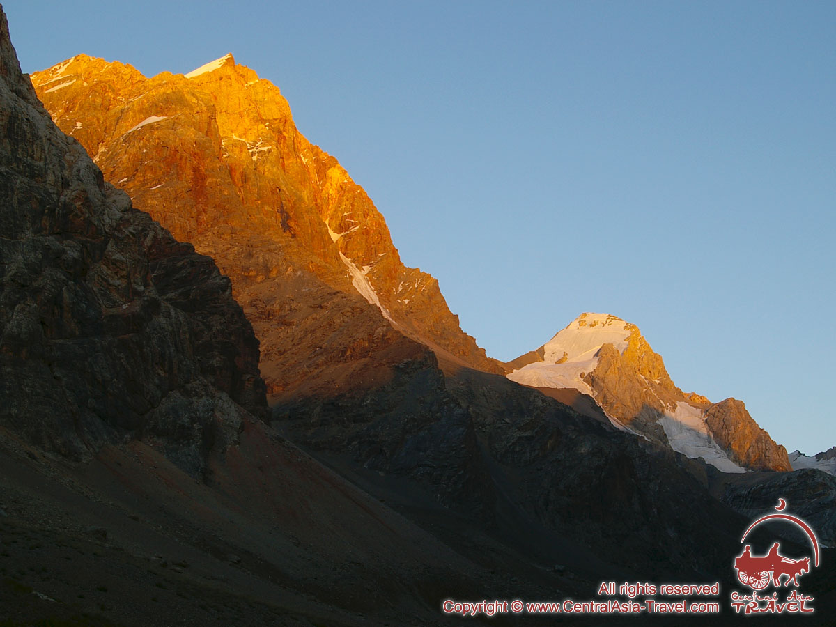
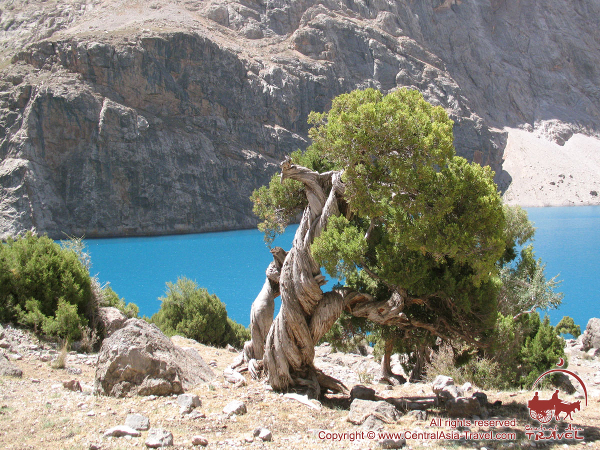
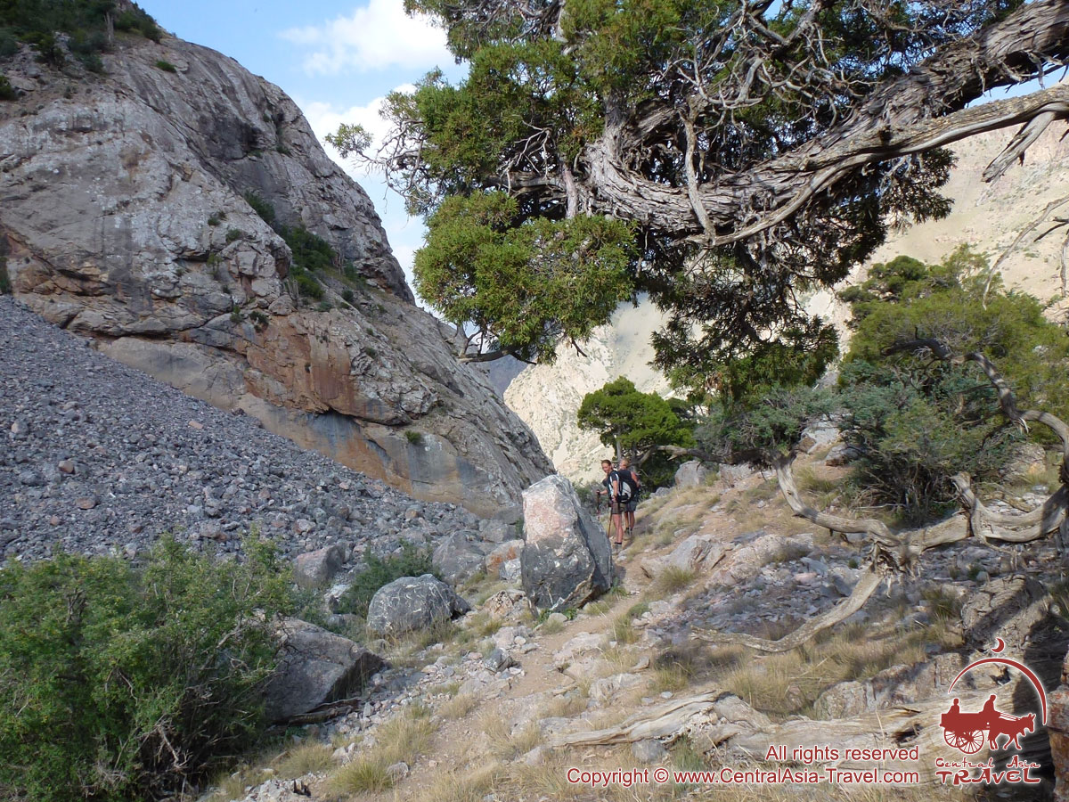
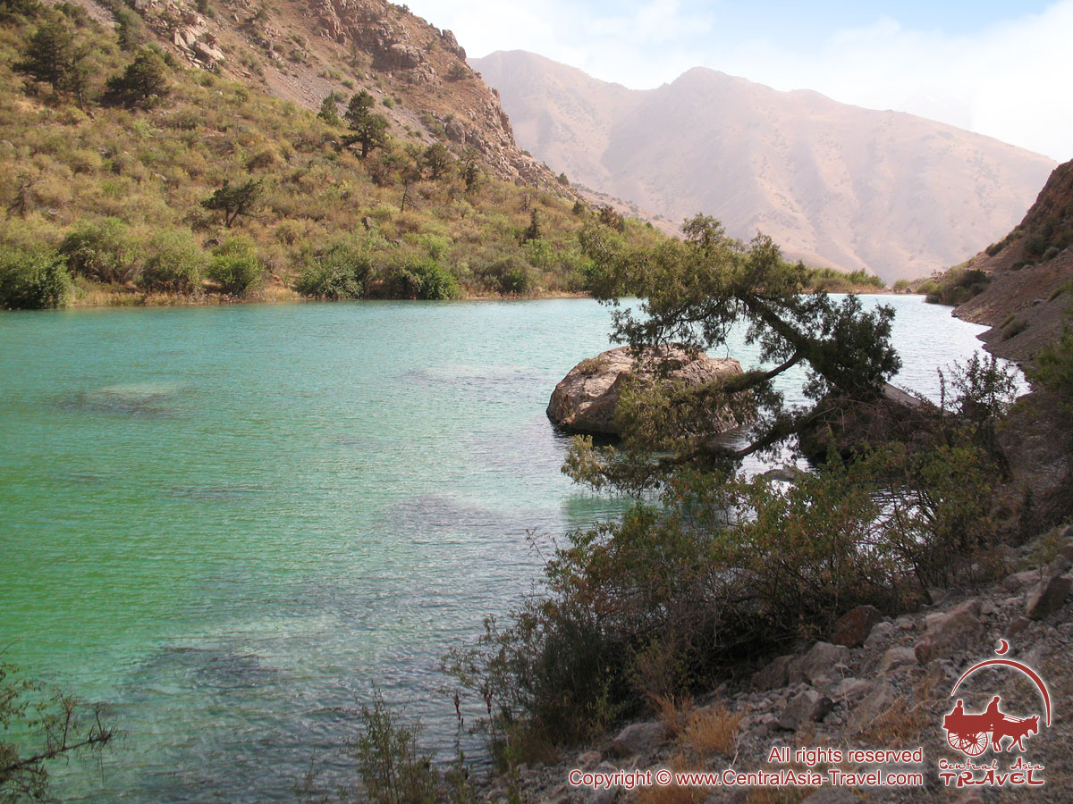
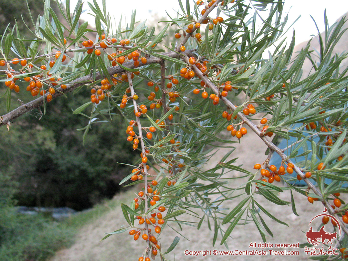
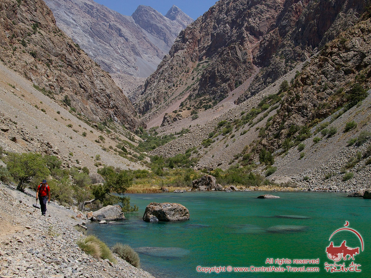
The Fann Mountains (also known as the Fanns) - a land of turquoise lakes, clouded peaks and ancient legends - is a unique part and one of the most beautiful regions of the Pamir Mountains. There are about 40 many-coloured lakes concentrated in a relatively small area amid wonderful mountain landscapes, at the feet of snow-clad high mountains, surrounded by emerald woods. Here almost moon’s landscapes are enlivened with tangles of juniper’s trunks twisted by some strange powers of wind and sun into improbable figures. Here amazing peaks Energia (5105 m) and Chimtarga (5489 m) are rising above Mutnye («turbid») lakes.
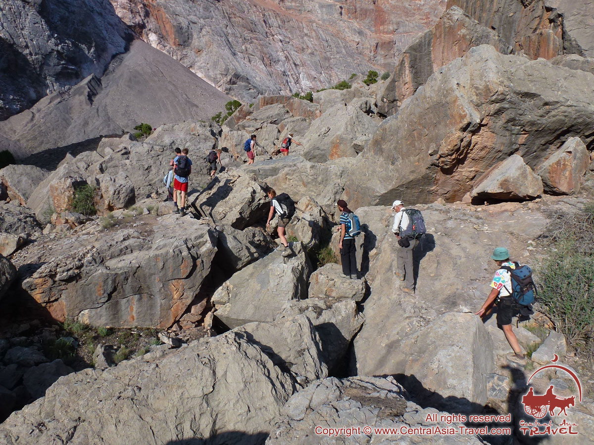
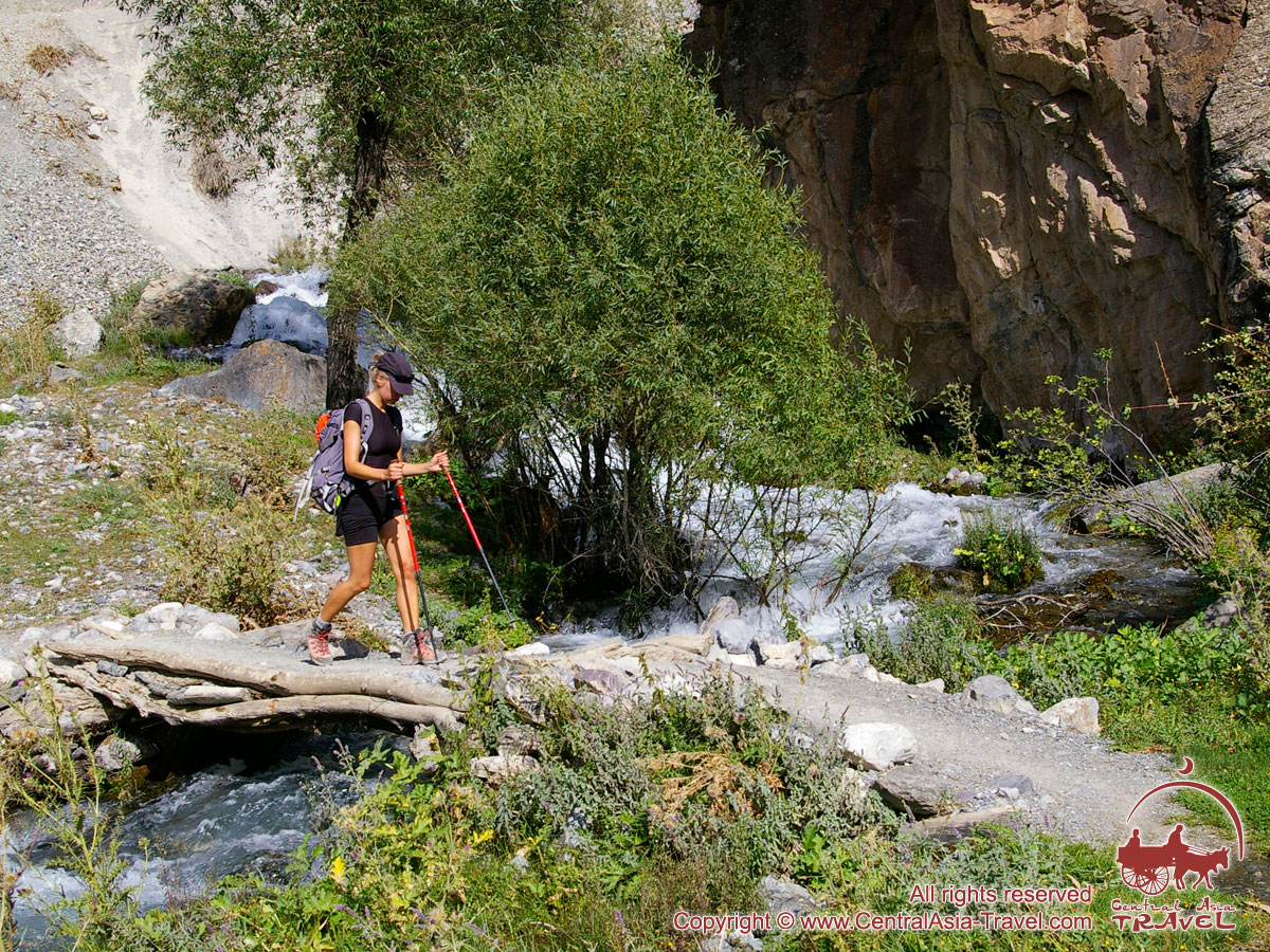
This trekking route runs through the most picturesque paths of Fann Mountains: picturesque gorges and passes, rapid rivers, ancient glaciers and splendid lakes, extensive vertical rocks and 5,000-odd metres high peaks.
- ITINERARY,
SERVICES & COST - USEFUL INFORMATION
VISA, PERMITS
| Tour program | ||
| Day 1. |
Arrival in Samarkand. Meeting at the airport. Transfer and check-in at a hotel. Arrival in Samakand. Meeting at the airport. Transfer and check-in at a hotel after 14:00. Samarkand is as old as Rome, it is one of the most ancient cities in the world and former capital of the great Tamerlane empire. It is a museum city, a city which was once the heart of the caravan trade in the midst of the Great Silk Road. Samarkand conserved its unique aura of the Oriental medieval age until this very day. Overnight at the hotel. |
|
|
|
||
| Day 2. |
Samarkand – Mountain camp “Artuch” (230 km, 2 h). Transfer to “Jartepa” Uzbek-Tajik land border and formalities; further transfer to the Zeravshan river valley and the mountain camp “Artuch”. Here our trekking in the Fan Mountains starts. This region is an incredibly beautiful corner abounding in alpine lakes and snow-capped peaks, situated at the junction of two major mountain ranges in the Pamir-Alai system – the Hissar and Zeravshan Ranges. Meals: breakfast, lunch, dinner. Overnight in the mountain camp “Artuch” (2200 m). |
|
|
|
||
| Day 3. |
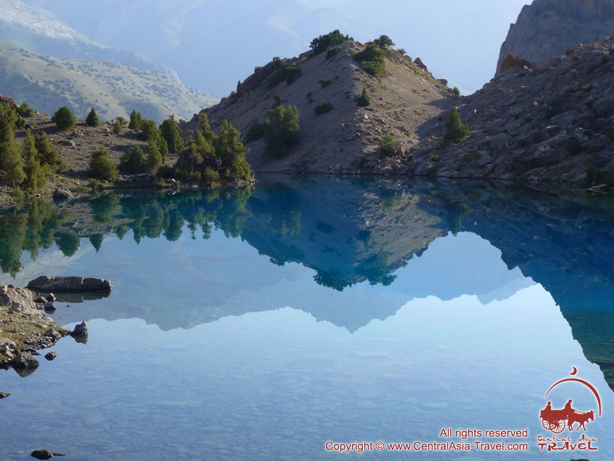
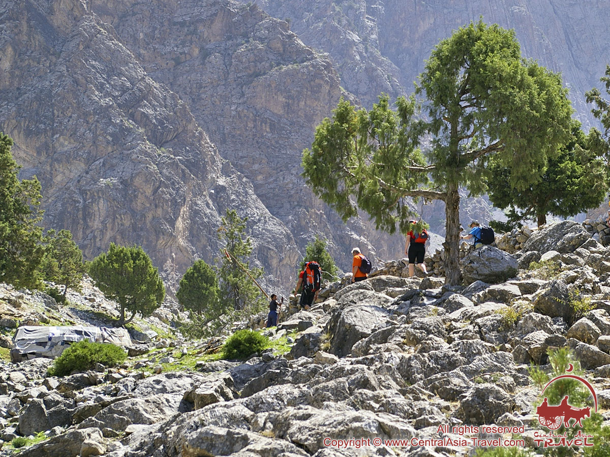
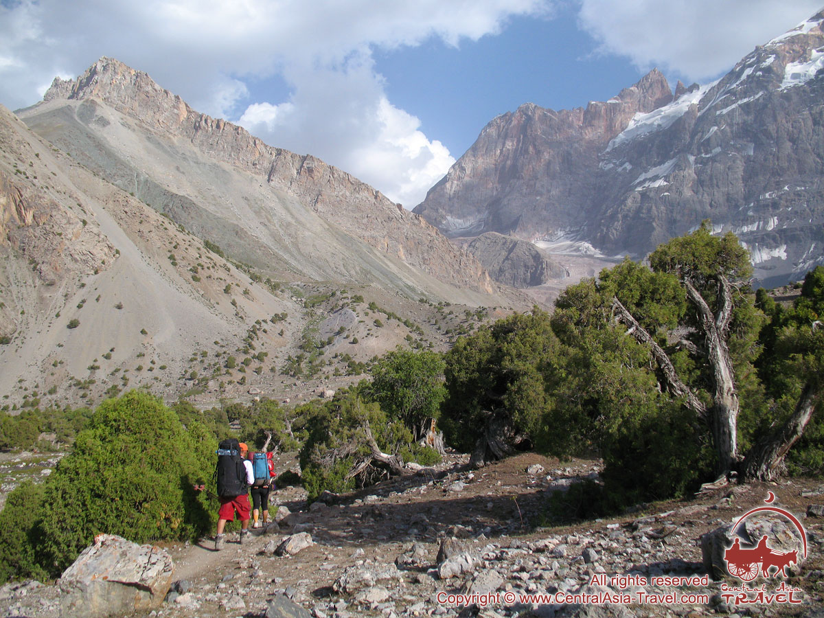
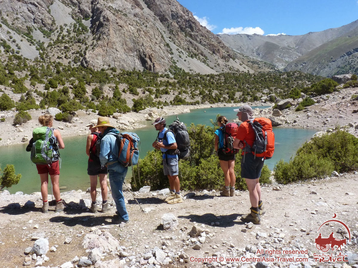
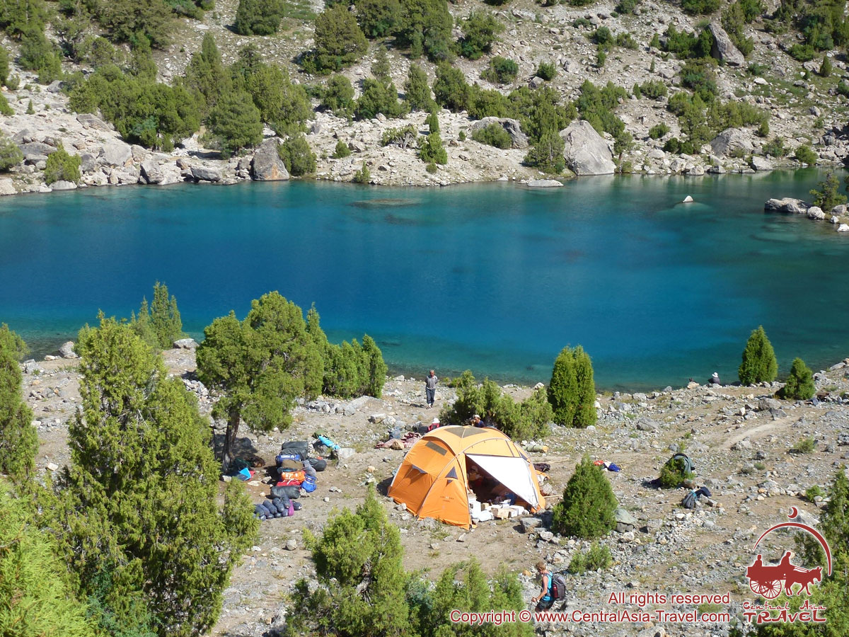
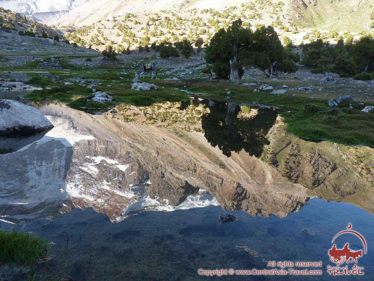
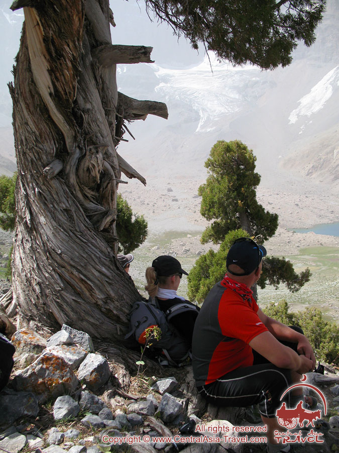
Mountain camp “Artuch”– Kulikalon Lakes (7 km, 5h). Well-trodden trail takes us up to Kulikalon lakes along the scree slope of the western part of the Kulikalon basin. We steadily climb up and enjoy a view to three peaks – Adamtash (4579 m), Mirali (5106 m) and Maria (4790 m) which making the famous Kulikalon Rock Wall. At the foot of the wall there are turquoise necklace of amazing Kulikalon Lakes. Our camp is located on a green meadow, on the shore of one of the lakes, Bibidjanat Lake. Travel time: 5 hours; altitude difference: + 642 m. Meals: breakfast, lunch, dinner. Overnight in tents (2842 m). |
|
|
|
||
| Day 4. |
Kulikalon Lakes – Alaudin Pass– Alaudin Lakes (7 km, 6 h). While ascending to the Alaudin Pass (3757 m) we enjoy a bird-eye view of Kulikalon Wall, Dushaha Lake and the entire Kulikalon Lake system at its foot. From the pass there's a grand view of amazing Alaudin Lakes, as well as the snow-&-ice-clad 5000+m peaks of the Fan Mountains: Chapdara Peak (5049 m), Bodkhona Peak (5152 m) and Zamok Peak (5020 m). Travel time: 6 hours; altitude difference: +915 m; – 971 m. Meals: breakfast, lunch, dinner. Overnight in tents (2786 m). |
|
|
|
||
| Day 5. |
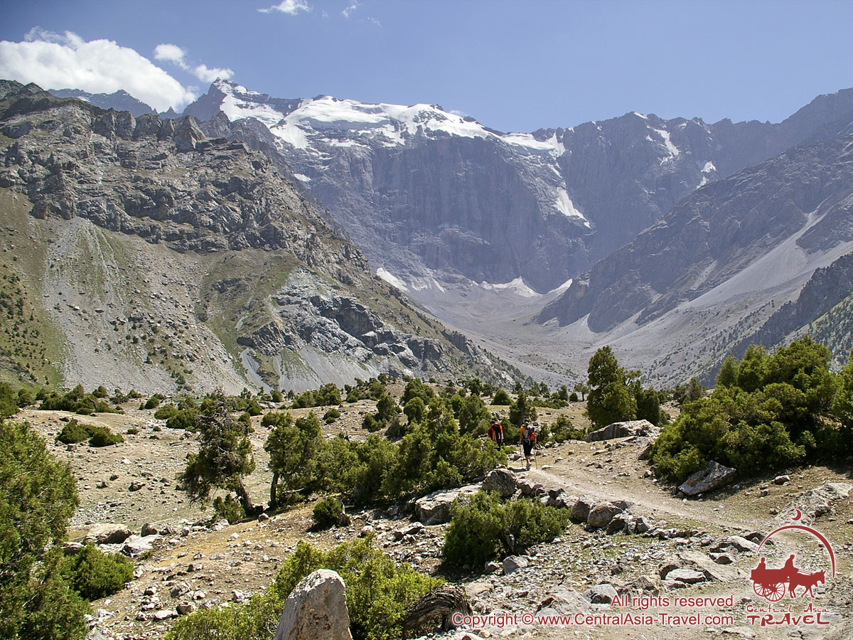
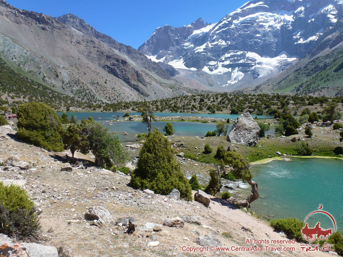
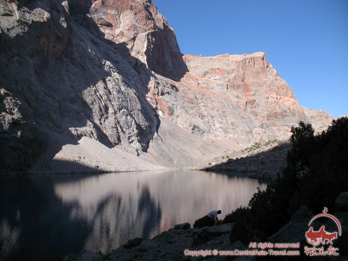
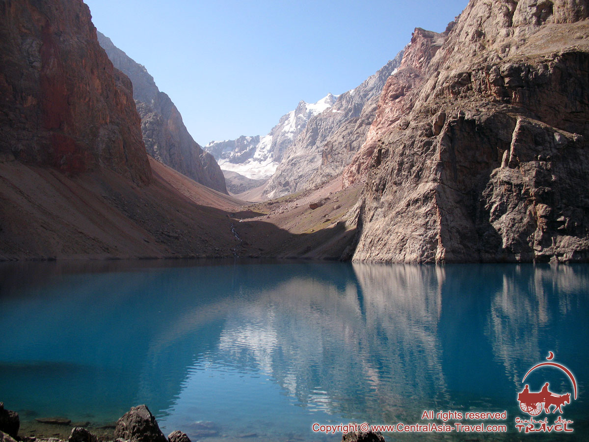
Alaudin Lakes – Mutnye Lakes (5 km, 4 h). Today our point of destination are Mutnye Lakes; they got their name because of the deep gray color of the water. The trail passes by the small lake Piala named for its round-shape bottom, and then takes us to the Mutnye Lakes located in the very heart of the Fan Mountains and surrounded by the most beautiful 5000+m peaks: Chimtarga (5489 m), Energiya (5120 m), Mirali (5106 m), Zamok (5020 m), Bodkhona (5152 m). They are especially beautiful after sunset, when the surrounding peaks are reflected in the water as in a mirror. Travel time: 4 hours; altitude difference: +700 m. Meals: breakfast, lunch, dinner. Overnight in tents (3490 m). |
|
|
|
||
| Day 6. |
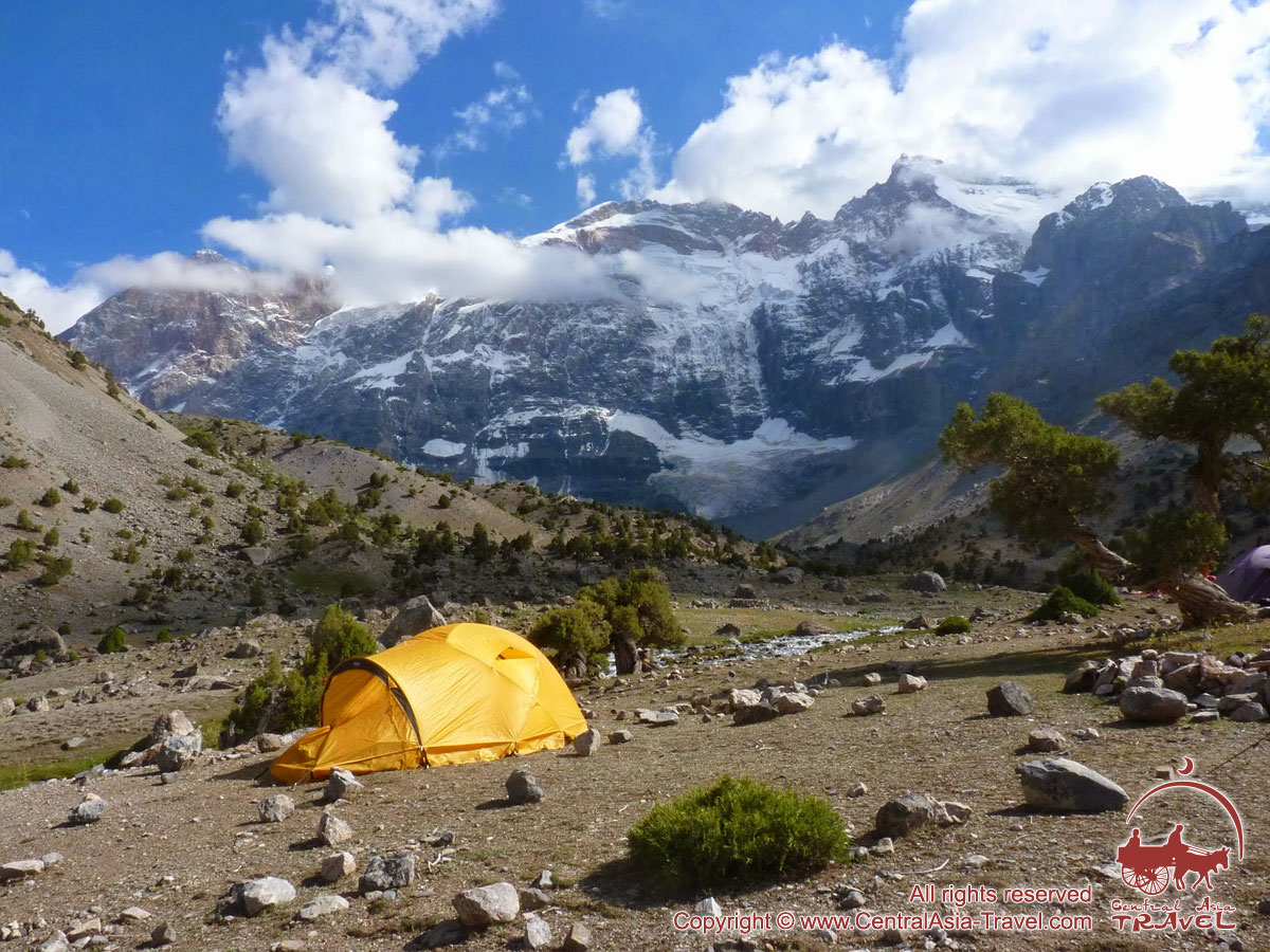
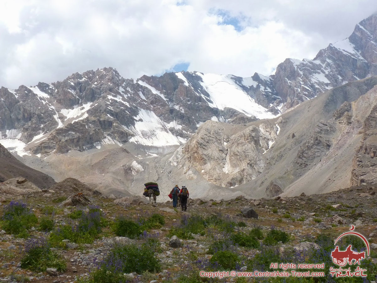
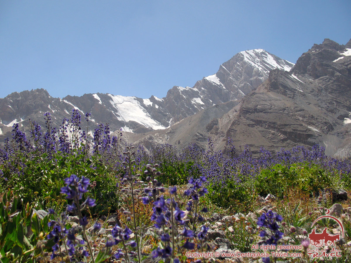
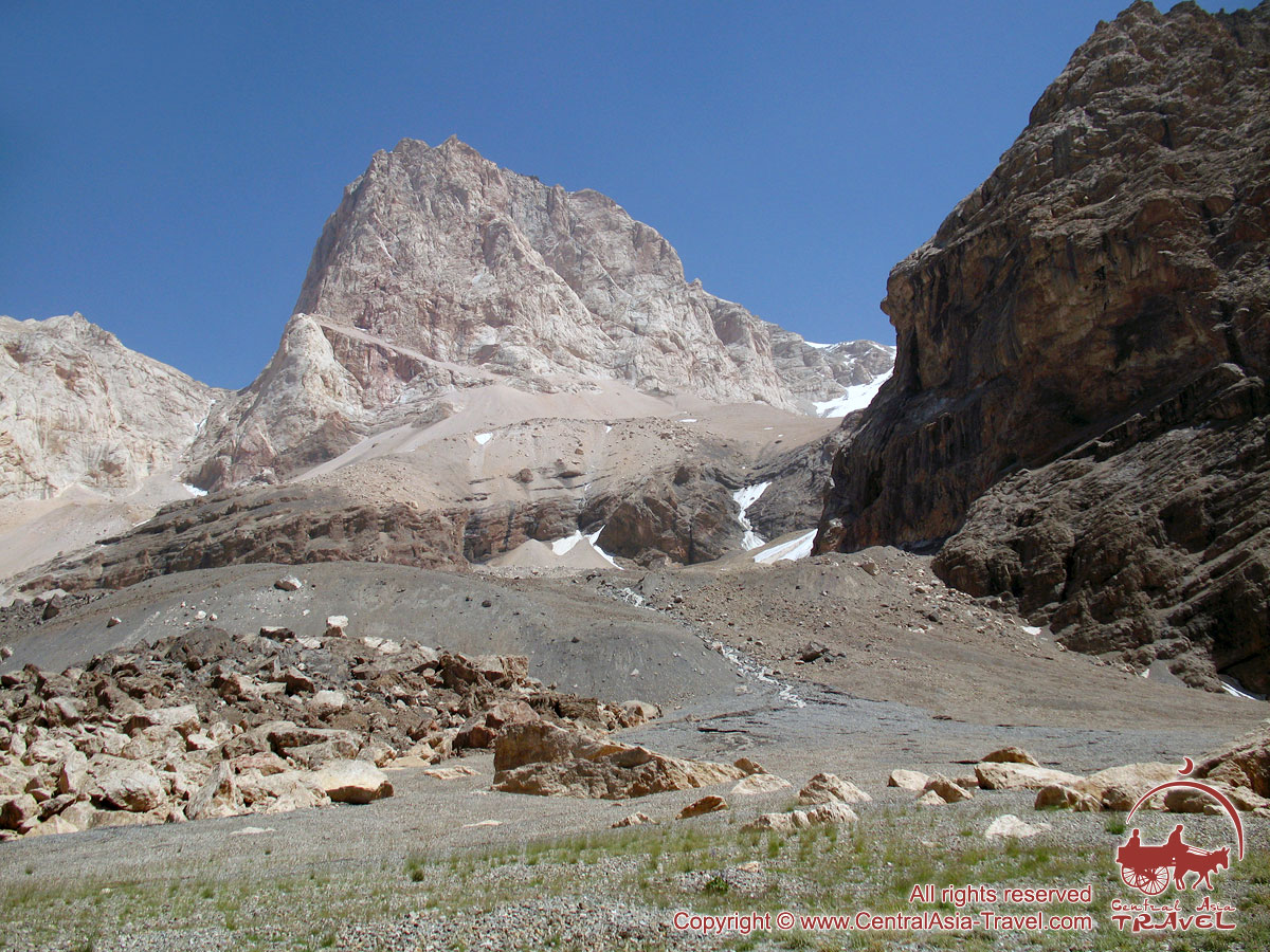
Mutnye Lakes – the Cirque of Chimtarga Pass (4 km, 6 h). The ascent to the cirque of Chimtarga pass is not difficult technically, but the altitude difference between Mutnye Lakes and the place of our next tent camp is more than 1000 m. Efforts will be rewarded with beautiful views of the dominant peaks – Chimtarga (5489 m) and Energiya (5105 m). Our camp is located at a height of 4500 m, that is the highest point of overnight stay of the entire route. The weather is quite cold there, and warm clothes will be required. Travel time: 6 hours; altitude difference: +1010 m. Meals: breakfast, lunch, dinner. Overnight in tents (4500 m). |
|
|
|
||
| Day 7. |
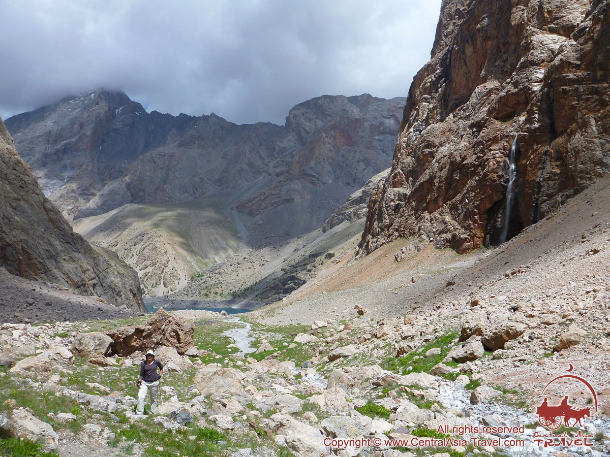
Chimtarga Pass – Bolshoje Allo Lake (12 km, 8 h). Today we will ascent to the highest point of the entire route - the Chimtarga pass (4780 m). Stunning views open from the pass: from the both sides of the pass there are Energiya Peak and Chimtagra Peak, and on the opposite side - the peaks of the Mutnye Lakes circle: Zamok (5020 m), Bolshaja (Big) Ganza (5306 m), Malaja (Small) Ganza (4946 m), Krasnye Zori Peak (4746 m) and others. Quite far away, on the south there seen the peaks of Hissar Range and on the North - the peaks of Zeravshan Range. Undoubtedly, most of us feel these moments as a climax of the trek. From the pass we descend to the Zindon Praviy (Right) River valley and get to the Bolshoje Allo Lake. Lake Bolshoje Allo was formed as a result of an earthquake in 1912, in a hollow between huge vertical rock walls. Travel time: 8 hours; altitude difference: +280 m; –1670 m. Meals: breakfast, lunch, dinner. Overnight in tents (3110 m). |
|
|
|
||
| Day 8. |
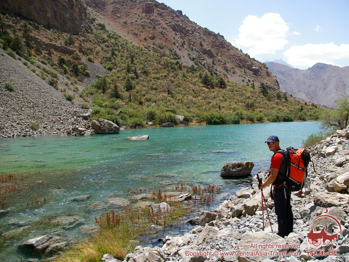
Bolshoje Allo Lake – Archimaidan River (10 km, 6 h). Transfer to Penjikent (70 km; 1,5 h). Descent along the Zindon River valley to the Archimaidan River valley. We overcome a giant blockage that collapsed in the earthquake of 1912 and formed Bolshoje (Big) Allo Lake. We overcome a giant blockage that collapsed in the earthquake of 1912 and formed Lake Bolshoje Allo. Then we will see the emerald-turquoise Maloje (Small) Allo Lake, located at an altitude of 2340 m. Visiting the shepherds' dwellings and tasting ayran – a healthy and refreshing fermented milk homemade beverage. After descending to the Archimaidan River valley - transfer to Penjikent and check-in at the hotel. Travel time: 6 hours; altitude difference: –1146 m. Meals: breakfast, lunch, dinner. Overnight at the hotel. |
|
|
|
||
| Day 9. |
Penjikent – “Jartepa” land border – Samarkand (60 km, 2 h). Transfer to “Jartepa” Tajik-Uzbek land border and formalities; further transfer to Samarkand. Samarkand is probably the best-known Uzbekistan’s historic city. Over 2,750 years of age, it has a rich history and boasts world-famous masterpieces of medieval Islamic architecture, most of which are UNESCO World Heritage Sites. Accommodation at the hotel after 14:00. Leisure time. Meals: breakfast. Overnight at the hotel. |
|
|
|
||
| Day 10. |
Samarkand (departure). Transfer to the airport. The end of the tour program. Departure from Samarkand. Meals: breakfast. |
|
|
|
||


|
||||||
| ||||||


|
The cost tour includes:
|
The cost of the tour doesn’t include:
|
Accommodation
This tour comes with the following accommodation:
| Location | Accommodation |
| Mountain camp “Artuch” | Accommodation in cottages, for 4 persons in a cottage |
| Fann Mountains | Tent camp |
| Penjikent | Penjikent Plaza 3+* / Rudaki 3* or similar |
| Samarkand | Arba 3* / Jahon Palace 3* or similar |
Transport.
During the tour the following types of transport will be provided depending on the number of people in a group:
In Tajikistan:
| Group | Venicle |
| Group 1–5 pax | "Hyundai Grand Starex" |
In Uzbekistan:
| Group | Venicle |
| Group 1–2 pax | "Chevrolet Lacetti" |
| Group 3–6 pax | "Hyundai Grand Starex" |
| Group 7–9 pax | "Toyota Hiace" / "King Long" |
| Group 10–15 pax | "Eurise" |
| Group 16–45 pax | "Golden Dragon" |
► Memo: Useful tips for tourists »»

Itinerary brief description
This trekking is rather easy and is suitable for anyone with good physical condition. Tourist above 16 and under 65 years of age can join this tour provided they have no serious health problems and their doctor does not object to participation in such kind of tourist activities. Children younger 14 can also join this trekking tour provided they are accompanied by their parents.
Trekking on foot covers from 7km to 10 km a day with altitude difference up to 1220m. The route runs at the maximum altitude of 4710m above sea level (Chimtarga Pass).
Each participant carries his own rucksack with personal belongings; group camping equipment and supply of provisions is transported by pack-donkeys up to Mutnoje Lakes and then by porters (donkey-handlers take donkeys away from Mutnoje Lakes back to mountain camp “Artuch”).
Typically the region enjoys rather stable weather: it’s warm and sunny, though some rain is possible, which relieves the monotony of the trip. The daytime temperatures range between +20° to +30°С, whereas at night the temperature can drop as low as +12 or +15°С.
Equipment on route
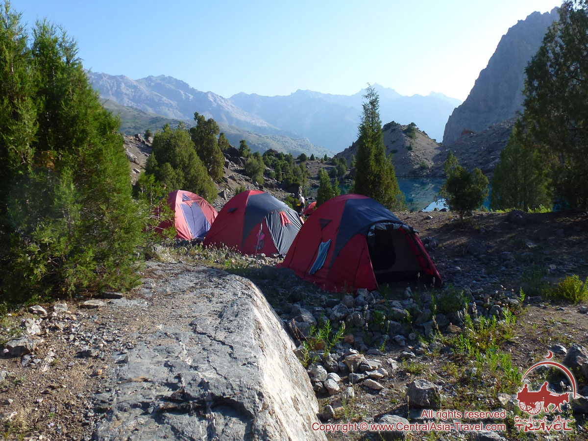
- Tents are used for accommodation of two persons. The tents are wind-resisting and water-proof and are suitable for any weather conditions.
- Tent camp also has a big hangar-like mess tent with tables and camp chairs.
Tables and chairs will be used only up to Mutnoje Lakes; and then care mat will be used as a table.
- Throughout the trek we provide quality tableware.
- To cook dishes during the trek we provide gas burner with gas cylinders or a supply of firewood.
- The tent camp is equipped with portable WC.
List of personal gear:
|
|
Service staff
Throughout the trekking travel you will be escorted by high altitude guide, who is the tour manager and our authorized representative. He is responsible for the safety and security of the group as well as decision making, including any changes in the route due to unforeseen circumstances that could threaten the health and well-being of the participants.
The tour is serviced by a team whose responsibility is to pitch and take down tents, lay the table for meals, wash up, pack the loads on horses, make fire and the like.
The team also includes a dedicated professional cook and a horse handler who is responsible for proper packing of the loads on horses and porterage.
Meals
Below you can find the menu of one of the trekking days:
Breakfast:
1) First dish: cereal porridge (semolina, oats, rice).
2) Second dish: cooked eggs with sausages, omelette, pancakes, thick pancakes, toasted bread, etc.
3) Buffet table: cheese, sausage, assorted bread, butter, ketchup, marmalade, chocolate paste, sweets, cookies, wafers, dried cream, honey, sugar, halavah.
4) Drinks: selection of hot drinks, such as tea (black and green), coffee.
Lunch*:
Buffet lunch: dried fruits, chocolate bar (1 chocolate bar for each participant in a day), variety of boiled cereals, mashed potatoes, sausages, canned fish, cheese, sausage, mixed salad (cucumbers and tomatoes), stewed fruit, cola, mineral and table water, fruits (apples) etc.
Dinner:
1) First course - salads;
2) Second course - soup (European or local cuisine).
3) Third course - various dishes of European cuisine with assorted garnish, as well as a choice of local dishes
4) Buffet table: dried fruits, cola, wafers;
5) Drinks: selection of hot drinks, such as tea (black and green), coffee.
6) Dessert: watermelon, melon, fruits.
Starting point
Tourists should arrive to Dushanbe - the starting point of the tour on the date the tour begins. All expenses connected with early arrival or late departure on completion of the tour should be covered by tourists themselves. In this case our company can arrange transfers to and from the airport as well as book the hotel.
No visa is required to enter Tajikistan and Uzbekistan for nationals of Russia and some of the CIS countries, however, foreign nationals are required to have a valid foreign passport.
Citizens of the most European and far abroad countries need visas to enter Uzbekistan and Tajikistan. The details on Uzbek and Tajik visa, rules of entry and stay on the territory of these countries you can find here.
To enter the territory of Uzbekistan and Tajikistan the foreign national must have a foreign passport valid for not less than 6 months following the termination date of the tour.
It is also important that before their trip foreign nationals arrange travel medical insurance with coverage of up to $10,000-15,000.
Please note that in order to formalize necessary papers (registration in a local foreign visits registration police department transliterated from Russian as OVVIG; also called OVIR) you should provide us with photocopy of your passport not later than 30 days prior to your arrival.
In case you can’t find the answer to your question on our site, please call our tour operators team for assistance.
E-mail: adventure@centralasia-travel.com
Route Map

Route Map
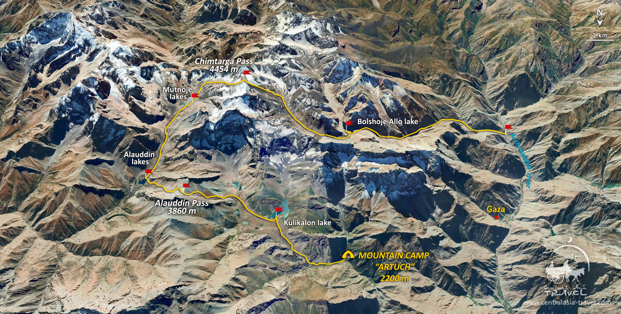
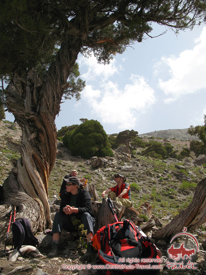
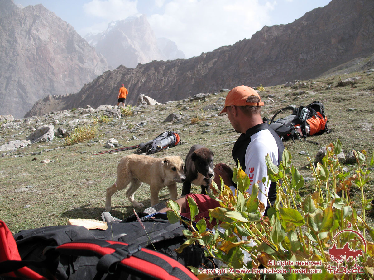
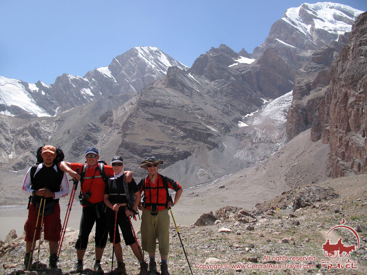
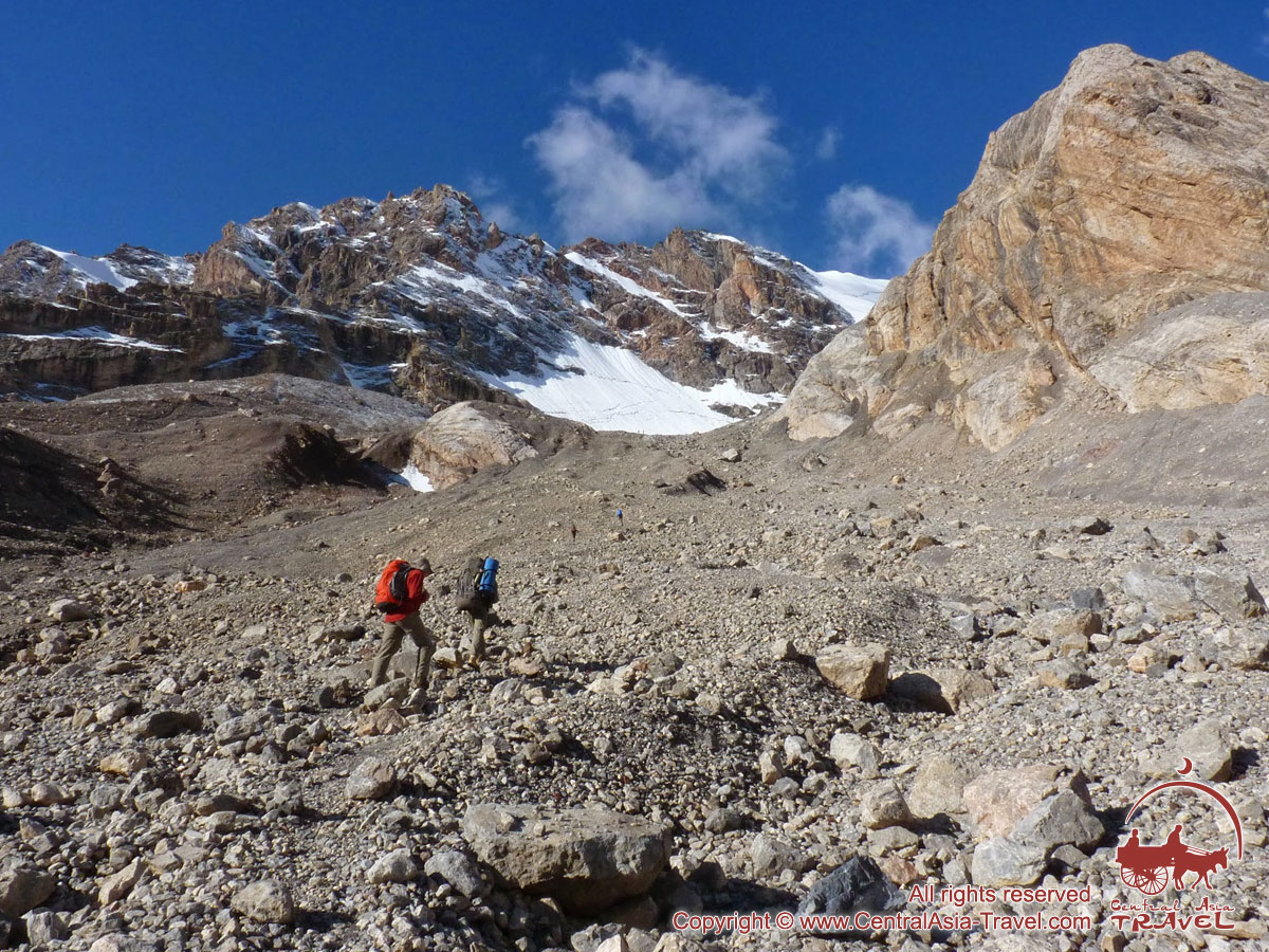
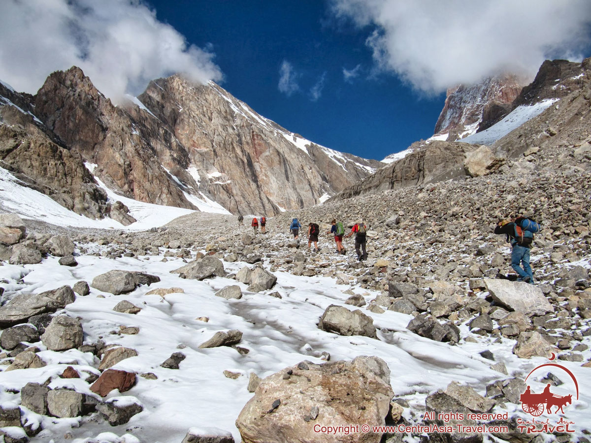
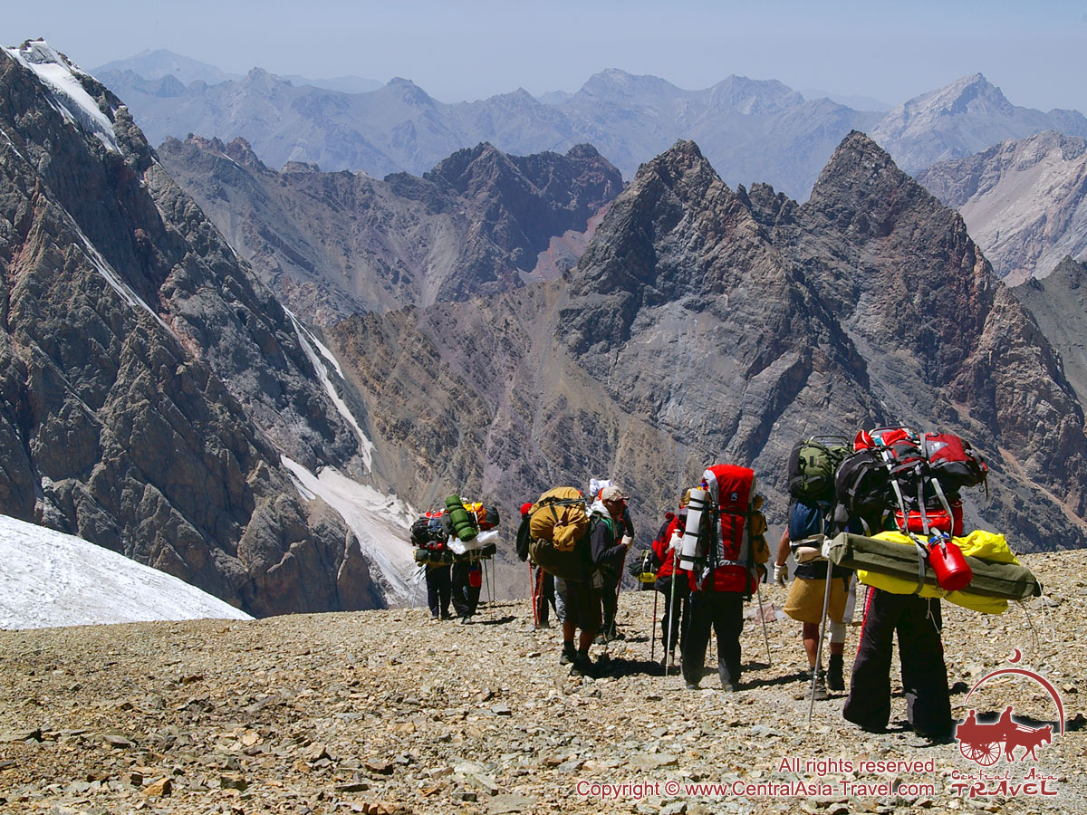
Photo of the tour:
 |
 |
 |
 |


Our video gallery:
 Trekking to Lake Sary Chelek |
 Riding motorbikes Riding motorbikesthrough Kyrgyzstan |
 In an off-road vehicle across Kyrgyzstan |
 RideThePlanet: RideThePlanet:Kyrgyzstan Whitewater |
© Material presented by «Central Asia Travel».
Copying and using all presented information and material is possible ONLY by authority of the originator.
Recommended heritage group tours: |
Recommended adventure group tours: |
Other interesting tours: |
Usefull links: |
TOUR ORDER
Book a guided tour
To submit the form you need to consent to the processing of personal data.


